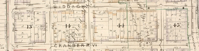
July 4, 1825 – Cornerstone Laid For The Building That Launched The Brooklyn Museum
The Apprentices’ Library was Brooklyn’s first free library and public reading room. The library association was incorporated in 1824 by Brooklyn benefactors like Augustus Graham. The founders aimed to provide “mechanics, manufacturers, artisans and others” with books and classes. As the name indicated, there was a focus on apprentices and young people who didn’t otherwise have access to free public education.
140 Clinton Street and 142 Clinton Street Are The Last Two Survivors
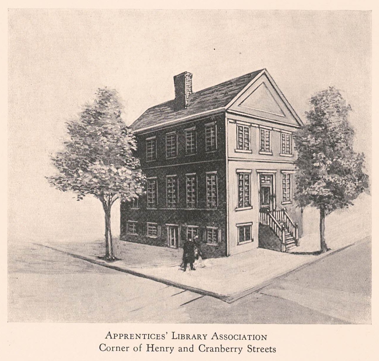
The short block of Clinton Street in Brooklyn Heights north of Aitken Place contains one of the most curious rows of houses in the neighborhood. For many years the five houses from 136-144 Clinton Street were known as “Honeymoon Row” – and today only 140 Clinton and 142 Clinton remain as originally built.
The original Honeymoon Row of five houses, shown in 1922. NYPL
The Gothic Revival style Honeymoon Row was built for William Evans in the mid 1850s. Evans was a Brooklyn tailor, operating since the 1840s on Atlantic Street. At that time, the street, since renamed Atlantic Avenue, was one of Brooklyn’s two main commercial thoroughfares, together with lower Fulton Street.
Charlotte Charlaque was one of the three people who first had gender affirmation surgery, beginning in 1928 in Berlin. Her birth name in 1892 was Curtis Scharlach. Her family moved from Germany to the US in the early 1900s and she became a US citizen after her father was naturalized. By World War I, she was living in New York and spelled her last name Charlaque. She returned to Germany in the 1920s and adopted the first name Charlotte. She worked as a translator, sang and acted, and became affiliated with the Institute for Sexual Science run by Magnus Hirschfeld, who later performed her surgeries.
This extraordinary photograph shows a group of working class, mostly immigrant women who lived in Willowtown. The private photo was later published in the Brooklyn Eagle in 1949. Most women whose photos made the paper in 1916 (and certainly women from Brooklyn Heights) were debutantes, brides-to-be or social activists, but in almost all cases: well-off. This image is remarkable for showing a completely different side of the neighborhood.
A Rowhouse Built in the Late 1840s with a Series of Long-Time Owners; Reconfigured into Multi-Family Housing before World War II; and Converted Back to Single-Family in the 1990s
(adapted from the 2024 Brooklyn Heights Designer Showhouse journal, published by the Brooklyn Heights Association)
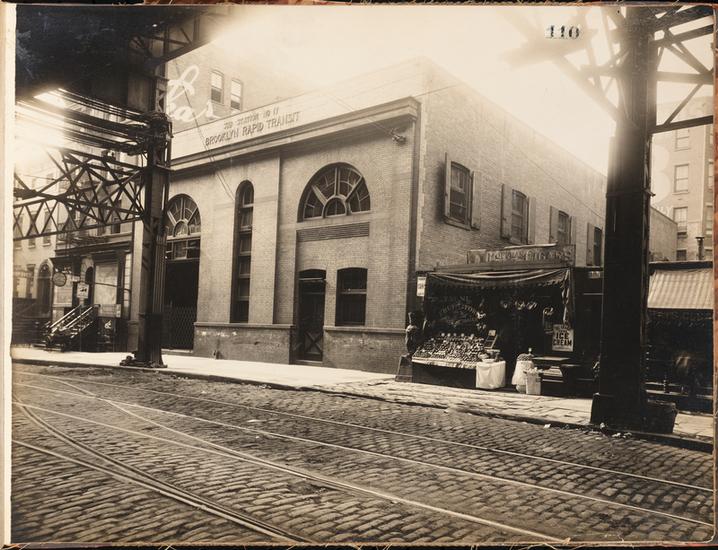
1960 photo – west side of Clinton Street looking north from State Street. 182 Clinton is one house in from the corner, with the ’55 two-tone Oldsmobile parked out front. Source: John D. Morrell photograph collection at Center for Brooklyn History.
182 Clinton Street’s Origin Story
The small farms and estates in what today we know as Brooklyn Heights began to give way to buildings in the early 1800s. But it would take almost 40 years after the initial era of construction for the area that now includes 182 Clinton Street to be developed. The building’s location, in the neighborhood’s southern end close to Atlantic Avenue, made it among the last places where houses were built. The economic boom and bust and the fights over real estate development in the area should sound familiar to any present-day New Yorker.
This Streetscapes feature in The New York Times by Aliza Aufrichtig & me is a visual scroll through 200 years of Brooklyn Heights real estate history. Featuring handwritten deeds, fire insurance maps, land surveys, original ads and lots of vintage & new pix.
The story is about how private land use rules dating back to the 1820s still dictate the neighborhood’s building development today. We traced the origins of a requirement for 8 feet of open space in front of buildings on a Remsen Street block. One developer says the restriction helped put the kibosh on their $180 million deal!
Here’s even more history & visuals behind the story.
Sometimes I do a deep dive “beyond the borders” of Brooklyn Heights. Here’s one of those stories.
A Twitter contact asked me if I knew the back-story of the four Park Slope streets that dog-leg across Fifth Avenue.
Take a look:
Sure enough, these four streets – Warren, Baltic, Butler and Douglass – each have a 30-to-40 foot northward jump as they cross Fifth Avenue from the west side to the east side. All of the other streets in the area’s grid are continuous when they cross Fifth Ave.
In 2022, this building became the home of the Asia Art Archive in America. The non-profit archive is the latest use in the richly varied history of this site.
The current building has been an art studio & residence, a car garage and a private carriage house. And before this building even went up, one or more wood-frame houses were on the site.
After I read this great BKReader piece about landmarking Jacob Dangler’s house at 441 Willoughby Avenue (northeast corner of Nostrand Avenue), I started digging into its history. Surprisingly, no one seems to know its exact age or the architect, despite some good guesses. I found the deets!