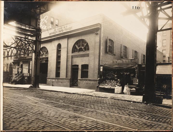
This relic of Brooklyn Rapid Transit elevated trains has been hiding in plain sight for decades on Sands Street in Downtown Brooklyn.
Forgotten NY posted a great history of Sands Street this week – which helped me solve a long-standing mystery.

I often walk by this MTA site, across from Cadman Plaza Park, that takes up an odd-shaped parcel left over from the construction of the Brooklyn Bridge ramps on Adams Street.
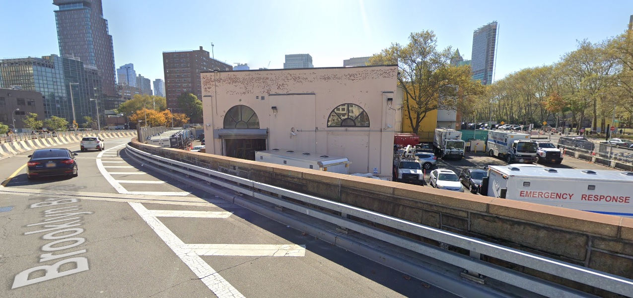
At first glace, the fenced-in parking lot doesn’t inspire much architectural wonder.
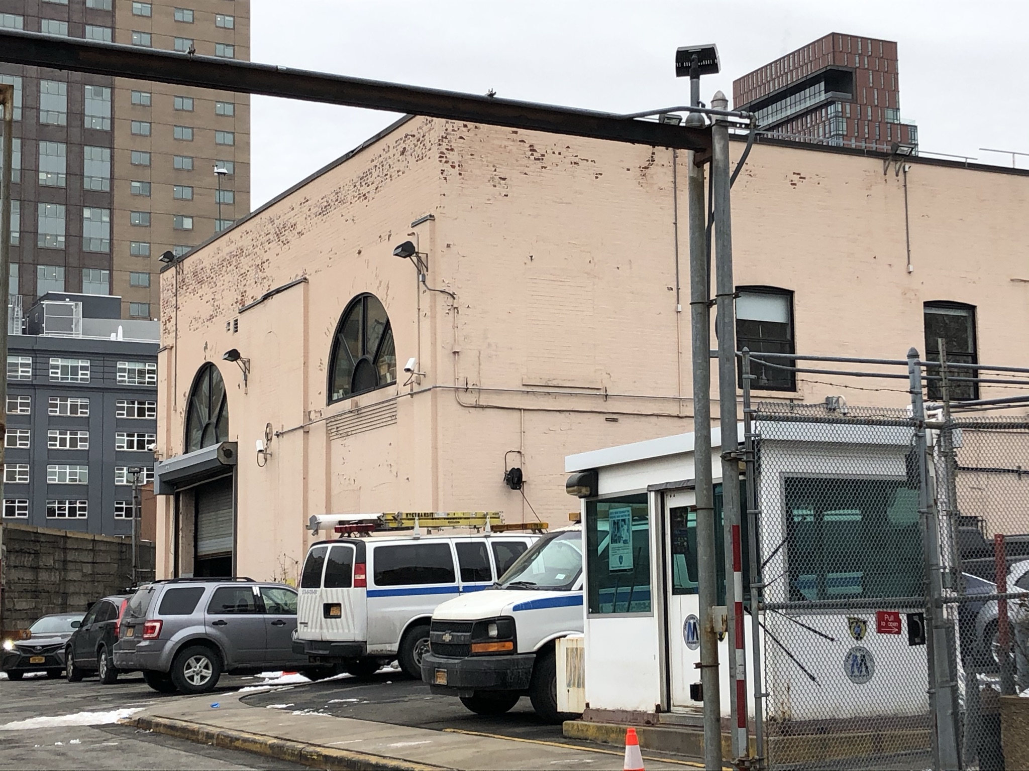
But, appearances can be deceiving. Look closely at the building in the rear. The arched windows are the giveaway – this is no ordinary garage.
Today’s MTA truck garage is actually a repurposed electrical substation from the Brooklyn Rapid Transit’s elevated trains.

The building was announced in 1902 and put up in 1903, shortly after the BRT was formed to consolidate the Brooklyn Heights Railroad and Brooklyn’s other el lines.

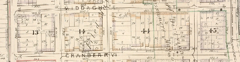
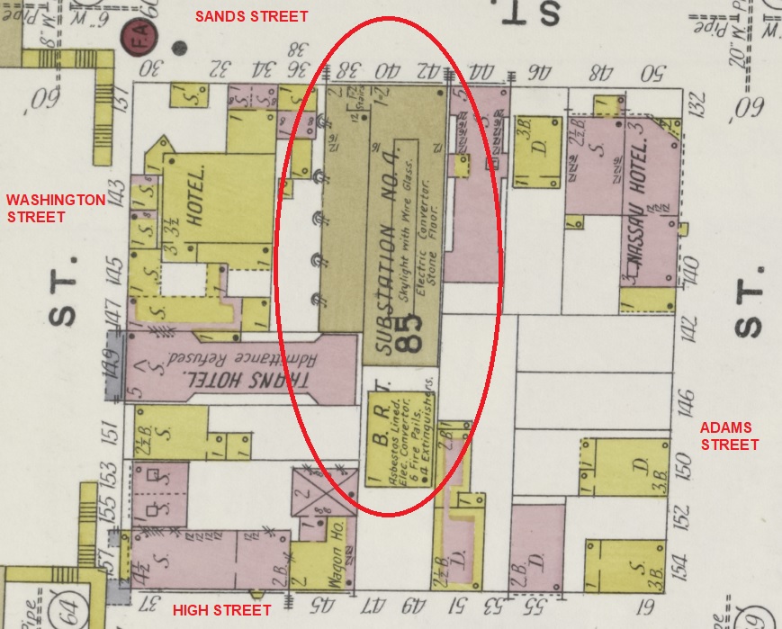
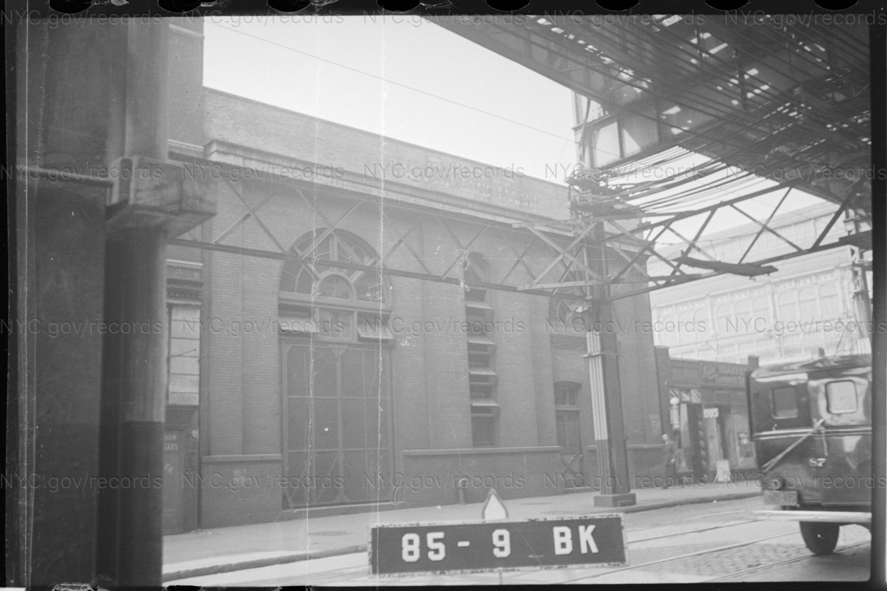
The 1904 Sanborn map labels it “BRT Substation No. 4.” In the c.1909 photo, you can just make out the name above the cornice — “SUB STATION NO. 4 / BROOKLYN RAPID TRANSIT.”
The builder, according to DOB filings, was the mysteriously named “Transit Development Co.,” which shared an address with the BRT on Montague Street.

The New York Times wrote a piece in 1904 about the Transit Development Co. — apparently the BRT’s elevated-line holdings seemed just as Byzantine to contemporaries as they do 120 years later. (After World War I, the BRT went bankrupt and was restructured as the Brooklyn-Manhattan Transit Corporation, or BMT, one of the forerunners of today’s consolidated New York City Subway.)

You can see some good pics of the substation building and its notable arched windows in the c.1940 tax photos from the Municipal Archives. (The Municipal Archives didn’t figure out the substation address when it put up its digital archive, but according to the Sanborn map, it would’ve had the range 38-42 Sands Street, and the newspapers referred to it as No. 42 Sands.)


Today you can also get a good view of the back of the substation building, which now abuts Red Cross Place but originally would’ve been in the middle of the block. The building had arched windows in the rear, too, bricked up today. Shortly after the substation was built, the BRT also put up a 3-story brick stable behind it, but that’s long gone.
(EDIT: today NYC Subway uses the facility as both the HQ/garage for its Hydraulics unit that services elevators across the system, as well a housing a control center for certain infrastructure monitoring. The MTA refers to the facility as 40 Sands Street or sometimes 42 Red Cross Place.)

(Until just now I had always thought that Red Cross Place might be a small, renamed vestige of High Street west of Adams Street. But in fact that’s not right — Red Cross Place is a new street that’s located in what would’ve been the middle of old block 85, before the bridge approach punched a hole through. The demapped stretch of High Street would’ve been right where today is the northern edge of the current OEM HQ building. This is actually quite obvious from a modern satellite map or even just glancing across the bridge roadway from Red Cross Place to the actual surviving piece of High Street — they’re not aligned. I just had never bothered to look closely.)
The BRT substation is the only building on all of Sands Street besides the YMCA building to have survived the wrecking ball of Robert Moses and his BQE, Cadman Plaza and Farragut Houses redevelopments from the 1930s to 1950s.
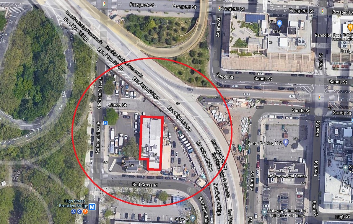
(Another interesting fact evident only from the satellite view – Sands Street actually has a tunnel under the Brooklyn Bridge ramps that today connects the two-city owned parcels on either side. You can see the roadway plates for the overpass in the photo.)
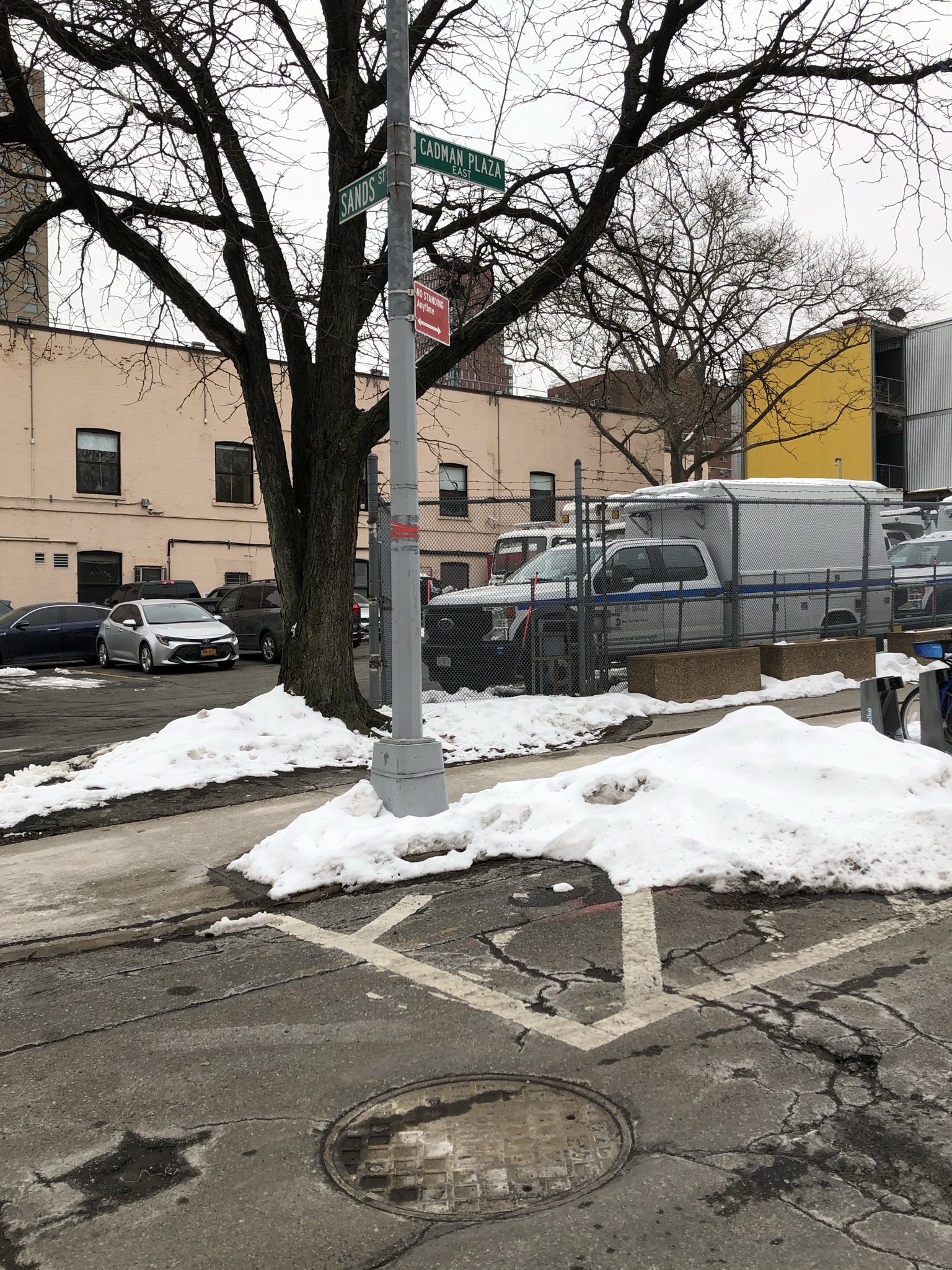
Maybe even better than this old, hidden-in-plain-sight substation building is the street outside. Look at the the corner of Sands Street and Cadman Plaza East (former Washington Street), where a curious Sands Street sign still stands even though the road immediately disappears beyond the MTA’s fence.
Just off the corner is a manhole cover in Cadman Plaza East that reads “BHRR” – for Brooklyn Heights Railroad. Somewhere down that hole, even before the BRT came into existence in the late 1890s, used to be wiring that connected the BHRR’s Myrtle Avenue el trains to the Sands Street station on the Brooklyn side of the Brooklyn Bridge.
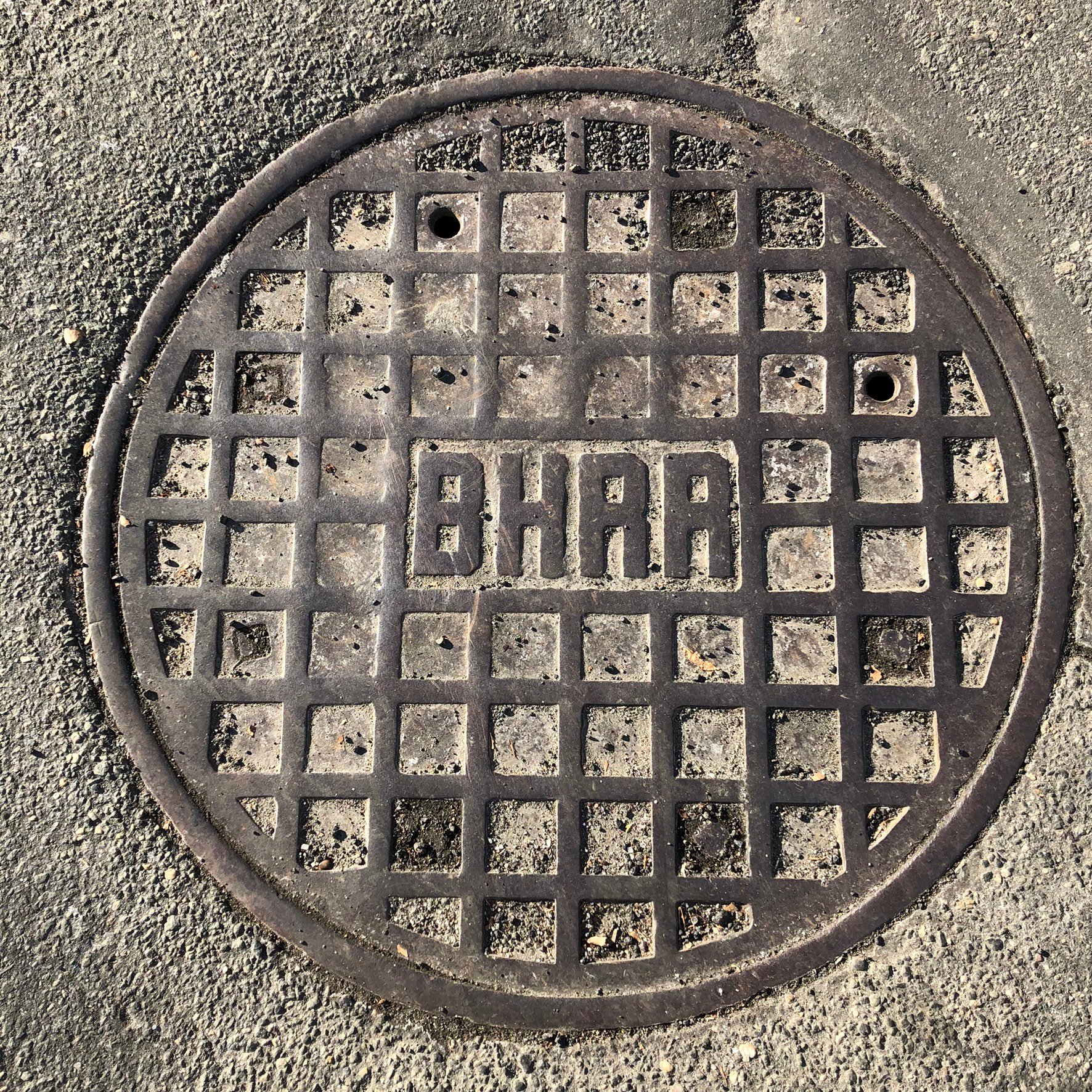
I wonder what’s down that manhole today.

Wow! I have been wondering about this building for years. Always assumed it was a carriage house. This is so awesome. Thank you.
Glad you liked it!
Hello, your article caught my attention as it appears my relative owned a shop at 58 Sands. He was responsible for a lot of the development in that area with co-ops, etc back in the 1800’s. I’m wondering if you can guide me on how I can possibly find more information on certain addresses? I’ve searched online and come up with nothing. I thank you in advance for any guidance you can offer. – Kathleene Campbell, Rutherford, NJ