Ephemeral New York wrote an intriguing post about a 1941 painting by Brooklyn Heights resident Miklos Suba. This is the artwork, titled “York Street/Flint Street Corner (House in Shadow)” –

York Street is easy to find on a DUMBO map, but you can’t find Flint Street today. So the query was: What happened to Flint Street?
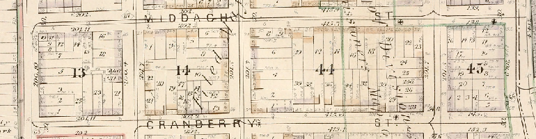
Here’s everything you wanted to know about Flint Street, which ran two short blocks between Prospect Street and Front Street, crossing York Street in the middle.
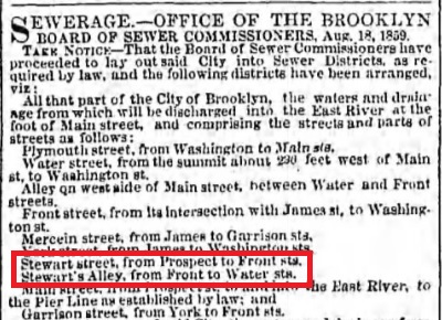
The street appears as an unnamed alley on Brooklyn’s first official map from 1819. It ran north behind the house of William M. Stewart, who lived on Prospect Street near the corner of Washington Street. By the early 1820s it started to make appearances as Stewart’s Alley in directories and newspapers, and the name was added to the city map. A couple dozen people were living in it then. Some were part of the ferry area’s large Black community; “washerwoman” was a common occupation.

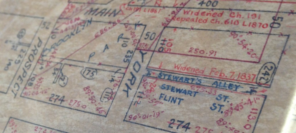
In 1837 the block between York and Front Streets was slightly widened, and both blocks legally renamed Stewart Street, but unofficially some people still called it Stewart’s Alley. To muddle matters further, by the 1850s, a tiny passageway had been opened up on the block north of Front Street, between the Campbell & Thayer Linseed Oil Factory complex and the rear yards of houses on Main Street. This passage was only roughly opposite the end of Stewart Street, but it too was given the name Stewart’s Alley.
In 1870 our short Stewart Street was renamed Flint Street to avoid confusion with Bushwick’s much longer Stewart Street.
Why was the name Flint chosen? The answer is probably lost. Maybe the name of a figure more known to the mid-19th century Brooklyn public than is obvious today. A Civil War hero? An old landowner never properly honored? Take your pick.
The “Stewart’s Alley” north of Front Street remained with that name after 1870, but ended up being demapped in the 1880s when the oil factory expanded, even before Gair Building No. 6 took over the entire block early in the 20th century.
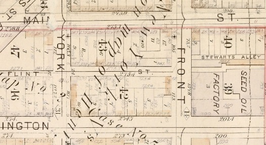
The southern end of the newly renamed Flint Street was turned into a dead end in the early 1880s when the Brooklyn Bridge was built, cutting off access to Prospect Street from Flint. By the early 1950s the BQE would claim the rest of the block south of York — all that’s left is the city-owned, fenced-in parking/storage area off of Washington Street. At the same time, the northern block between York Street and Front Street also got demapped when York’s underpass below the Brooklyn Bridge was usurped for the BQE. Robert Moses bent York to avoid the highway, and got rid of that block of Flint Street altogether (and a block of Main Street too). Today the parking garage to 70 Washington Street (old Gair Building No. 5A) sits on top of the former northern block of Flint Street.
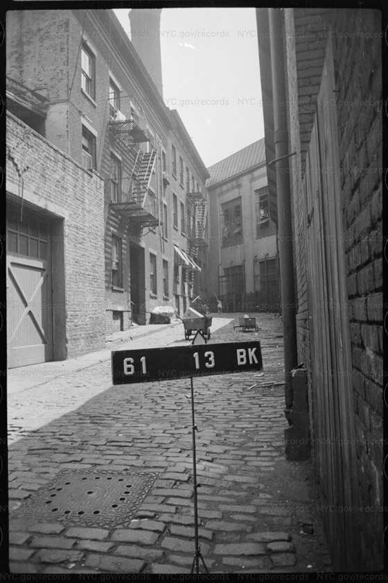
This NYC Municipal Archives tax photo (c. 1940) is looking south down Flint Street from York Street, showing the dead end at the Brooklyn Bridge. This would be just out of the right side of the frame in Miklos Suba’s painting:
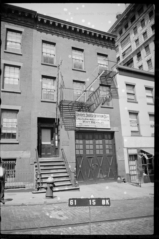
Another photo from the Municipal Archives, showing the fronts of the buildings on Washington Street (c. 1940) whose rears on Flint Street are shown in the painting’s background:
Everything pictured and shown on the maps — all these low-rise 19th century buildings (mixed in with a few early 20th century garages and light industrial buildings) — were demolished for successive waves of development. First the Brooklyn Bridge. Then the Gair cardboard box factory. Then, most destructively, the Brooklyn-Queens Expressway. Virtually all the residents were displaced from this part of what’s called DUMBO today.
This 1939 Sanborn map shows the direction of the painter’s viewpoint — looking southeast. The white space at the corner of the block is the empty, fenced-in lot at the foreground of the painting:


This is a fabulous deep dive with great photos. Thanks for putting it together!